Join our team at upcoming events across the globe, including Big Data & AI World, Shoptalk, GEO Business, Home Delivery World, & Geospatial World Forum
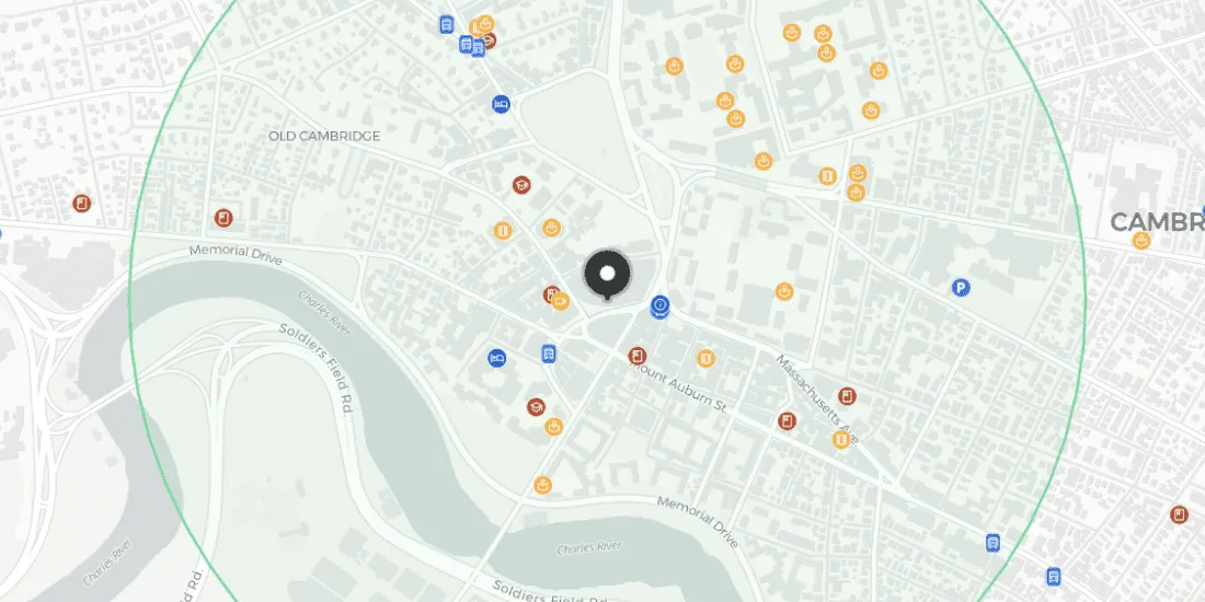
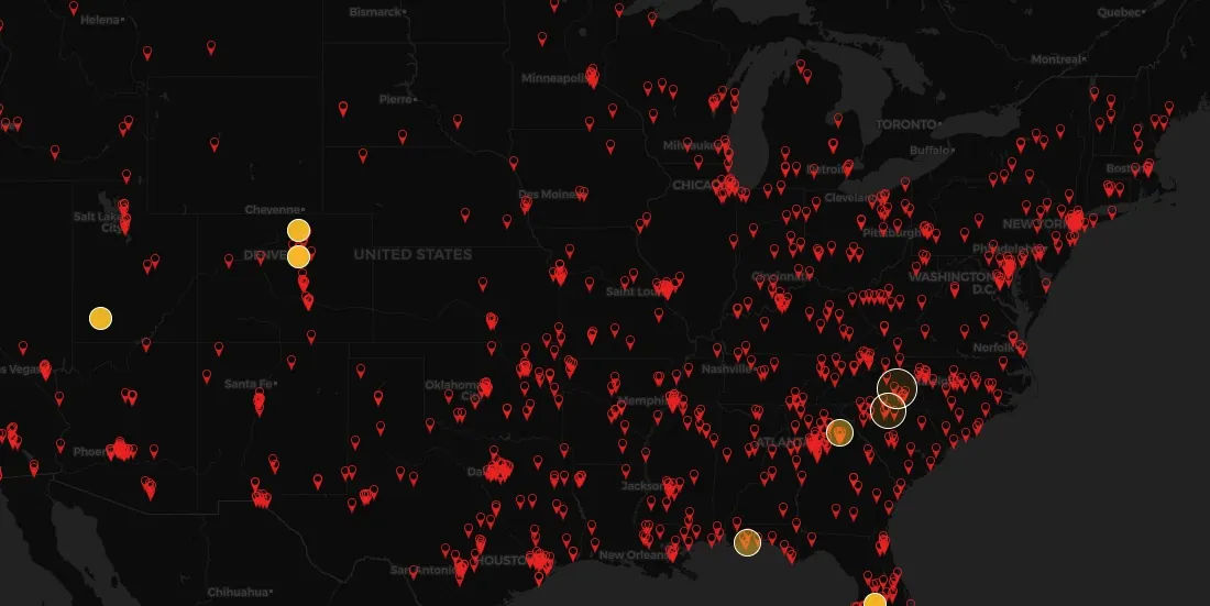
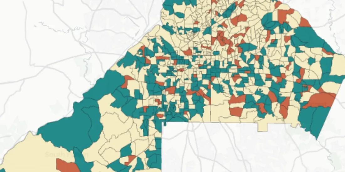
As the world’s population ages, discover how Assisted Living Facility owners & Private Equity can use CARTO for Site Selection to identify new optimal locations
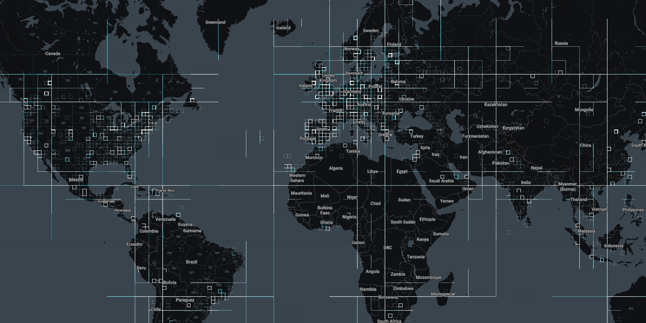
Including the launch of a new cloud native version of our leading Location Intelligence platform & closure of a $61 million Series C round check out our recap of 2021!
#SDSC21 Online starts today! Join thousands of spatial leaders from around the world over 4 days to discuss & learn about the future of Spatial Data Science.
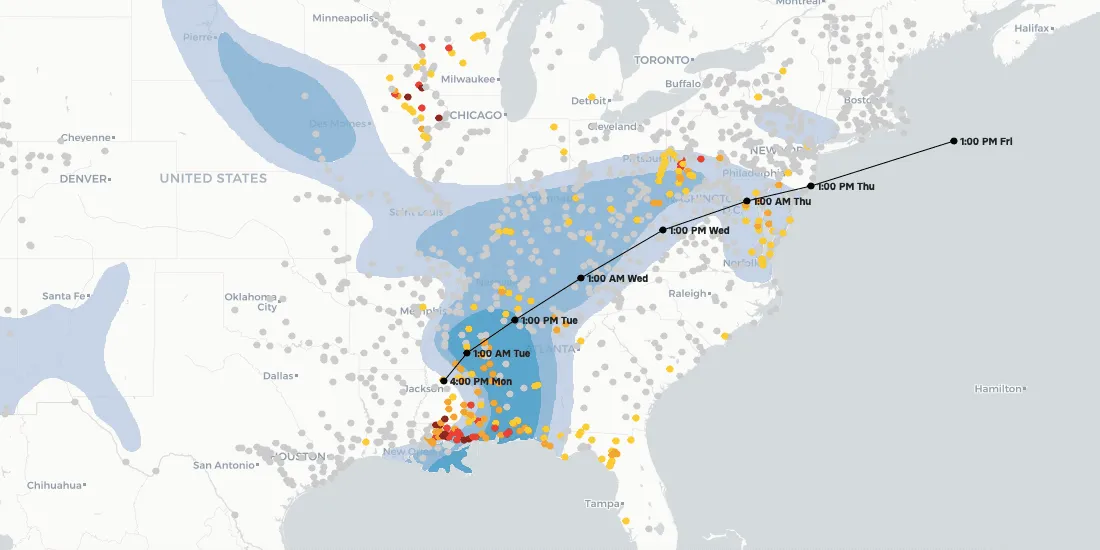
Climate change is contributing to extreme weather with increasing bursts of hurricanes, wildfires, & floods. See how maps can help plot, predict, & protect.
The disruption of global trade flows & a shortage of drivers has led to a global supply chain crisis. Read how Location Intelligence can be a road out of the crisis.
Wind energy is poised to be a significant contributor to national decarbonization goals, while there is enough wind available to power the nation, local siting challenges could have national implications. See how NREL is using location intelligence to better understand wind potential and it’s interaction with national clean energy targets.
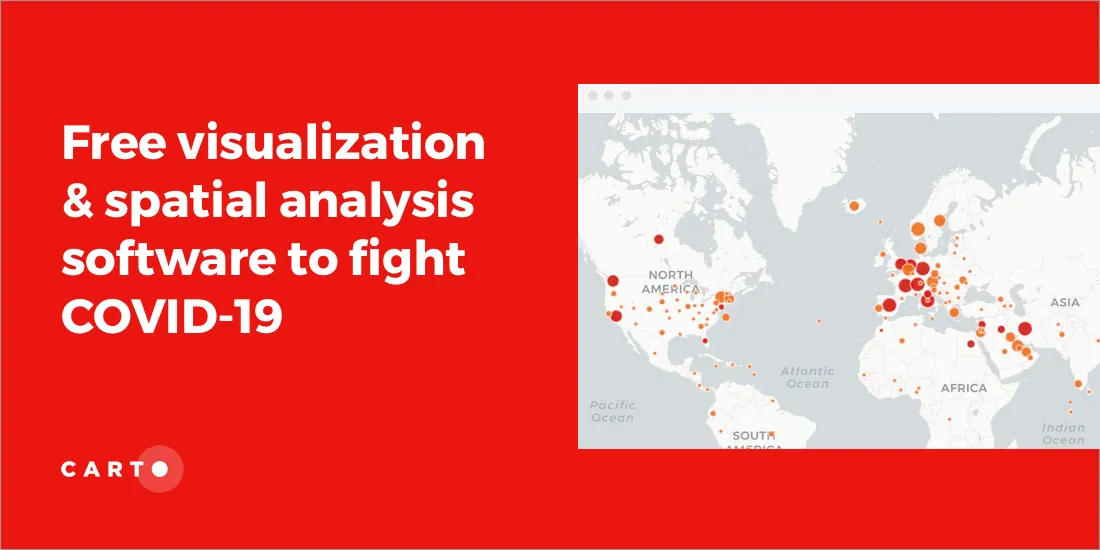
18 months since CARTO made it’s platform free to public & private sector organizations fighting coronavirus, we look back at some of the hundreds of grants.
We are pleased to announce our return to in-person events! Discover the events we will be attending this year including Big Data LDN, Groceryshop, & ODSC West.
Want to connect with thousands of Spatial Data Science experts? Speak at #SDSC21 & be part of the biggest & most global community of Data Scientists with spatial expertise
Following the successful industry-specific #SDSC21 events earlier this year we are pleased to announce the Spatial Data Science in Telecoms & Utilities Summit
Hand washing is key in the fight against COVID-19 but in Brazil water access can be an issue. Discover how Location Intelligence can be used to analyze the impact.
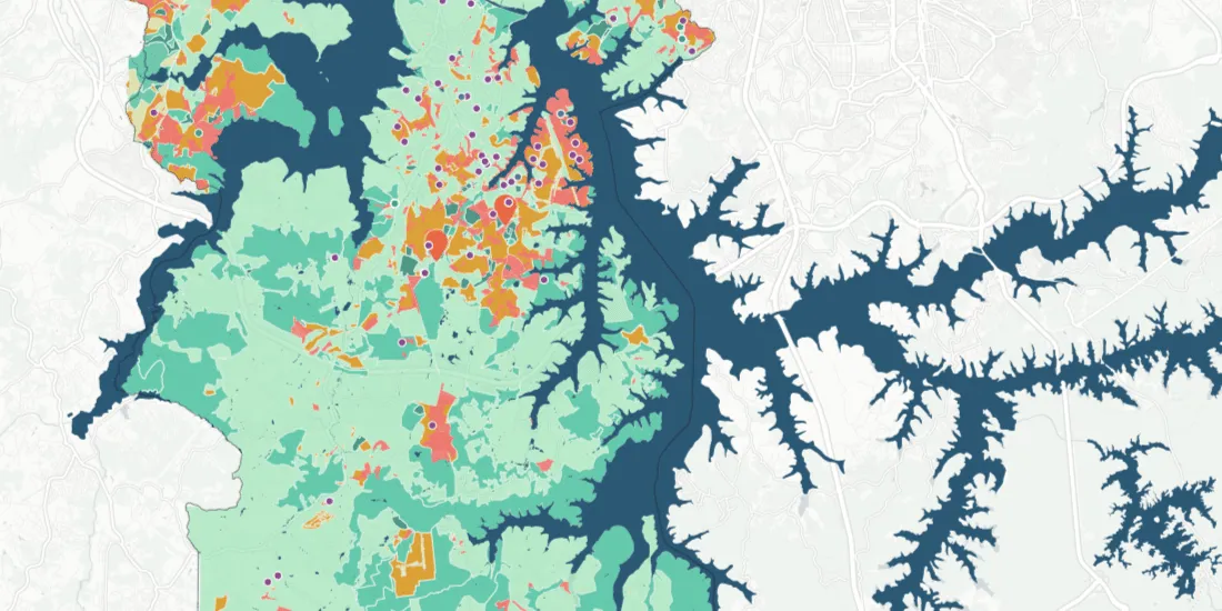
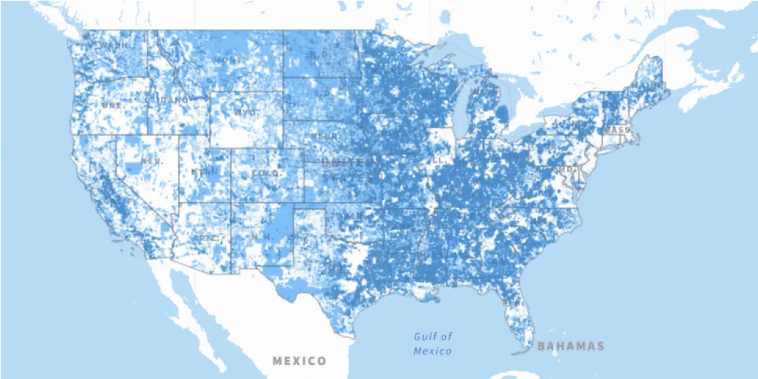
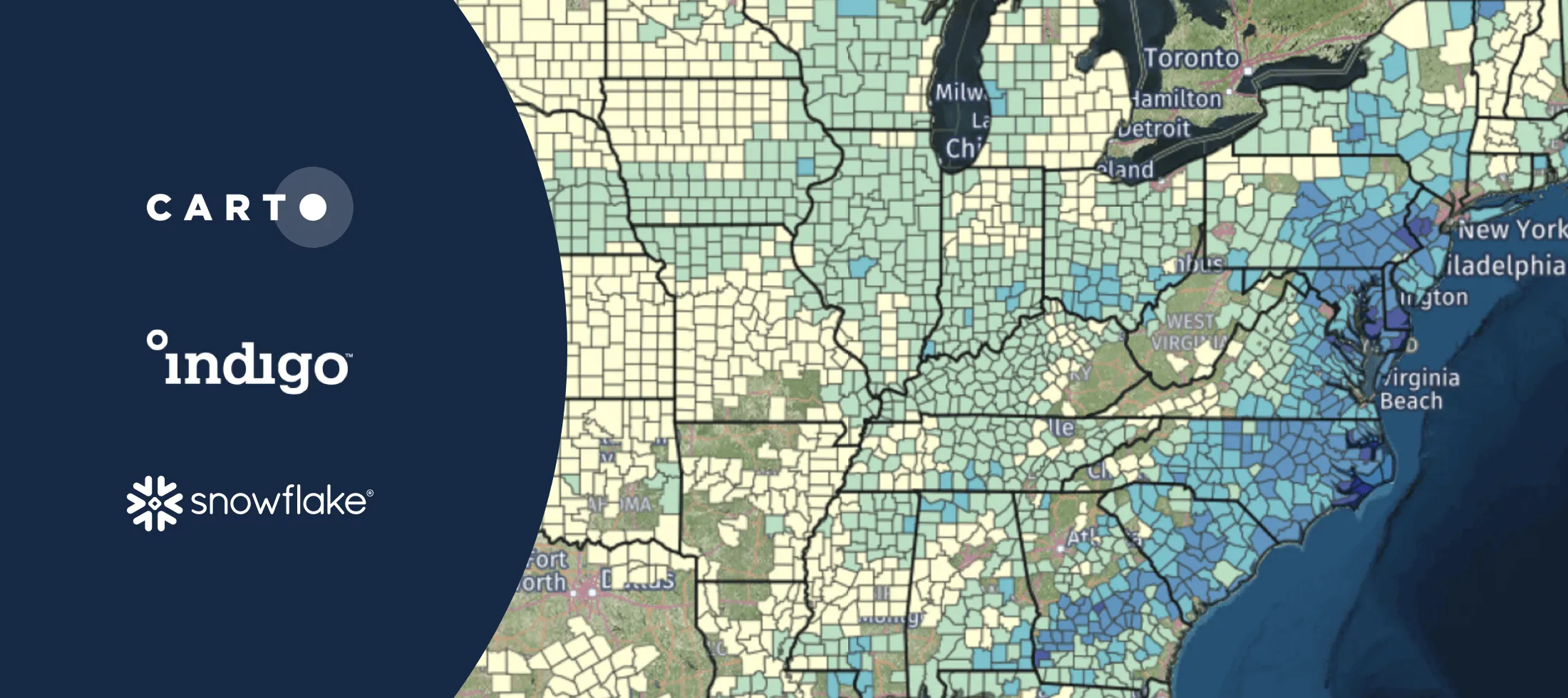
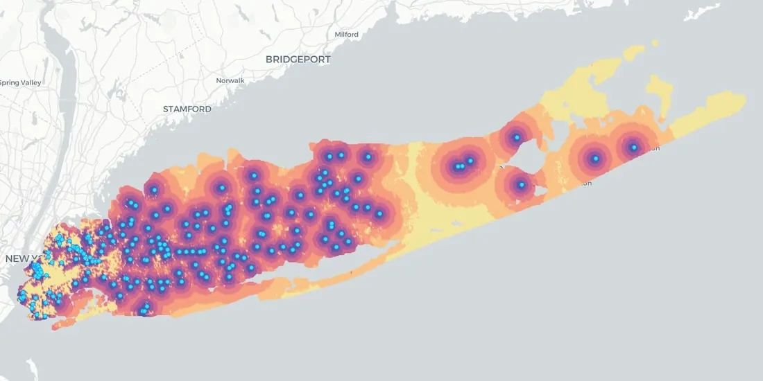
The Connect America Fund aims to close the digital divide between rural & urban America. Learn more about it's impact with a newly updated map from the USAC.
We are very pleased to announce the appointment of Javier de la Torre, Founder & CPO of CARTO, to The Open Geospatial Consortium's (OGC) Board of Directors
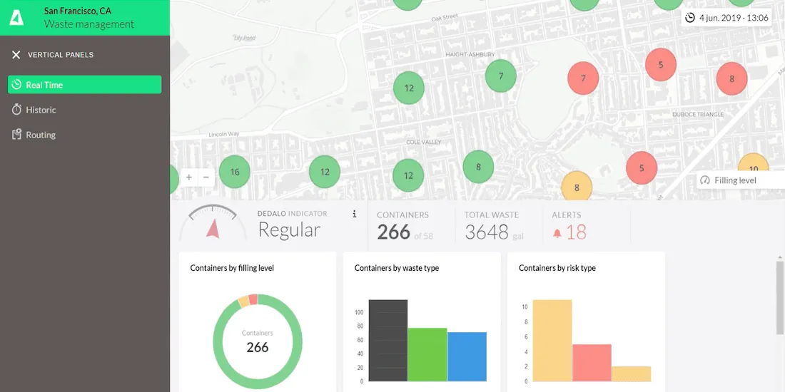
The pandemic has significantly affected waste management in our cities - read how Location Intelligence can be used to optimize collection & reduce costs.
How can Location Intelligence be used for Sustainability? Discover some examples including sustainability for agriculture, environment, mobility, cities, & more
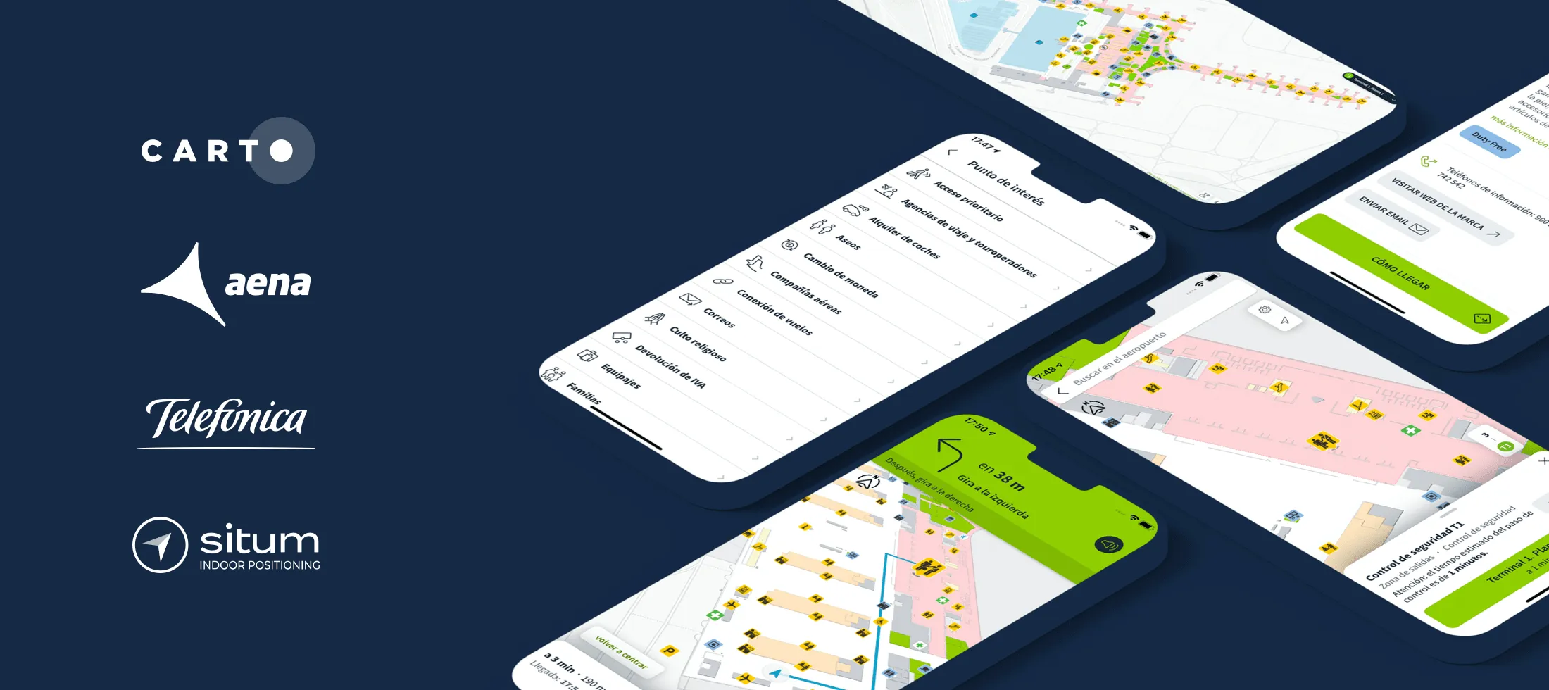
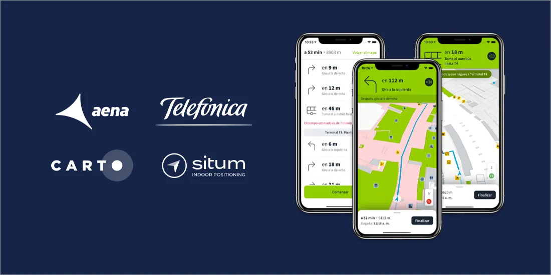
AenaMaps, a solution developed by CARTO, Telefónica, & Situm, leveraging indoor mapping to provide navigation within Aena's airports expands to Barcelona
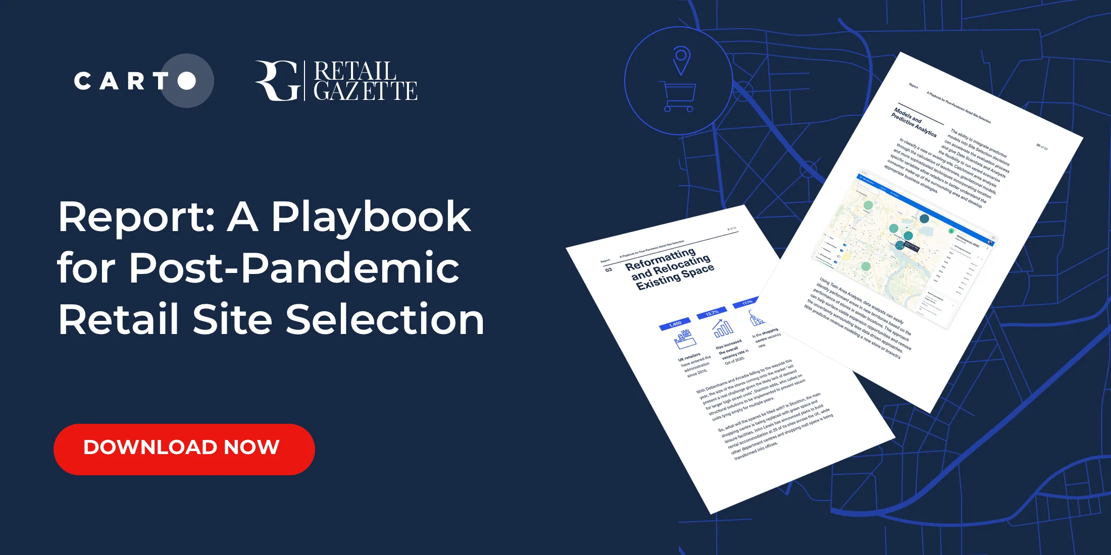
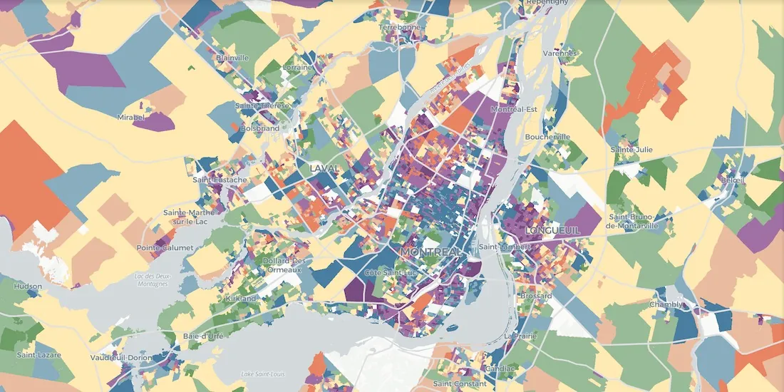
Download our new report on site selection strategies & how location data & advanced spatial analysis can help retailers adapt & thrive in a post pandemic world
As COVID vaccines become more widely available we look maps analyzing the rollout & supply chain optimization for an efficient & equitable immunization strategy
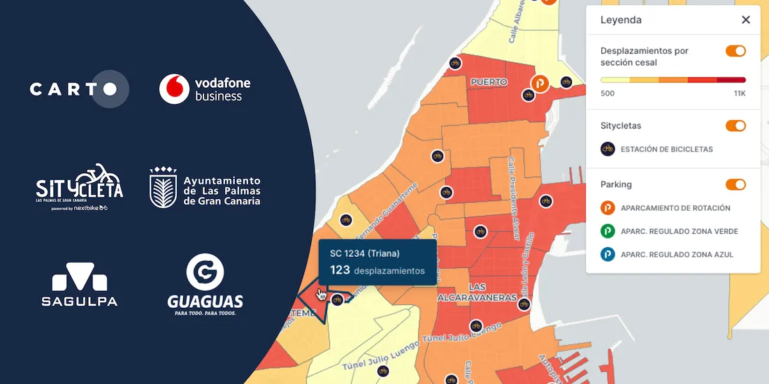
Optimizing transport infrastructure spatially is key to the future of mobility - see how CARTO, Vodafone, & SAGULPA built a platform for the city of Las Palmas
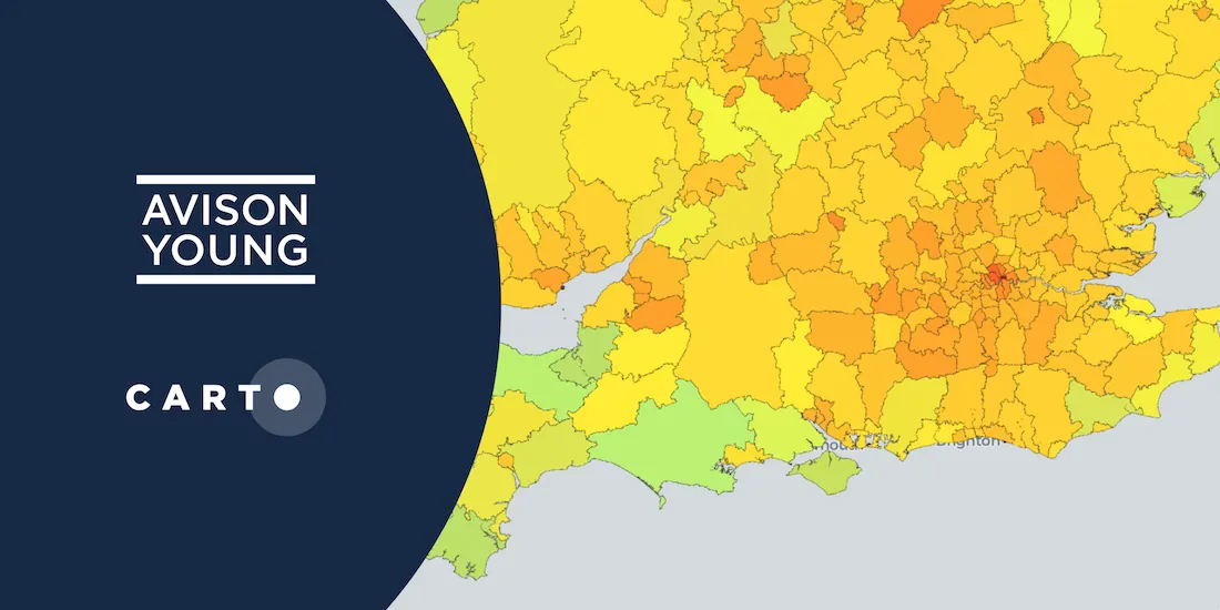
Explore Avison Young's UK Cities Recovery Index, monitoring commercial real estate rebound post-pandemic, analyzing diverse sectors, and predicting recovery trajectories.
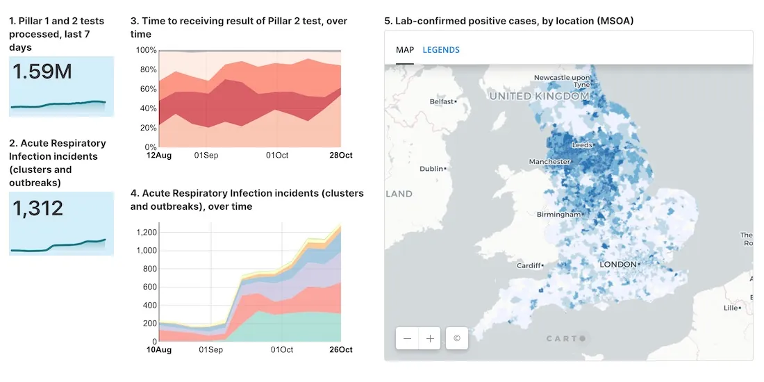
As cases of Coronavirus rebound, having an effective Test & Trace system in place is crucial. A new dashboard with maps evaluates the NHS response in England.
Modern Distribution Management, encompassing supply chain network design & logistics optimization, is going through a transformation. See why spatial is key.
#SDSC20 Online starts today! Join thousands of spatial leaders from around the world over 5 days to discuss & learn about the future of Spatial Data Science.
Aena, in collaboration with CARTO, Telefónica, & Situm has launched 'AenaMaps', a solution leveraging indoor mapping to provide navigation within its airports.
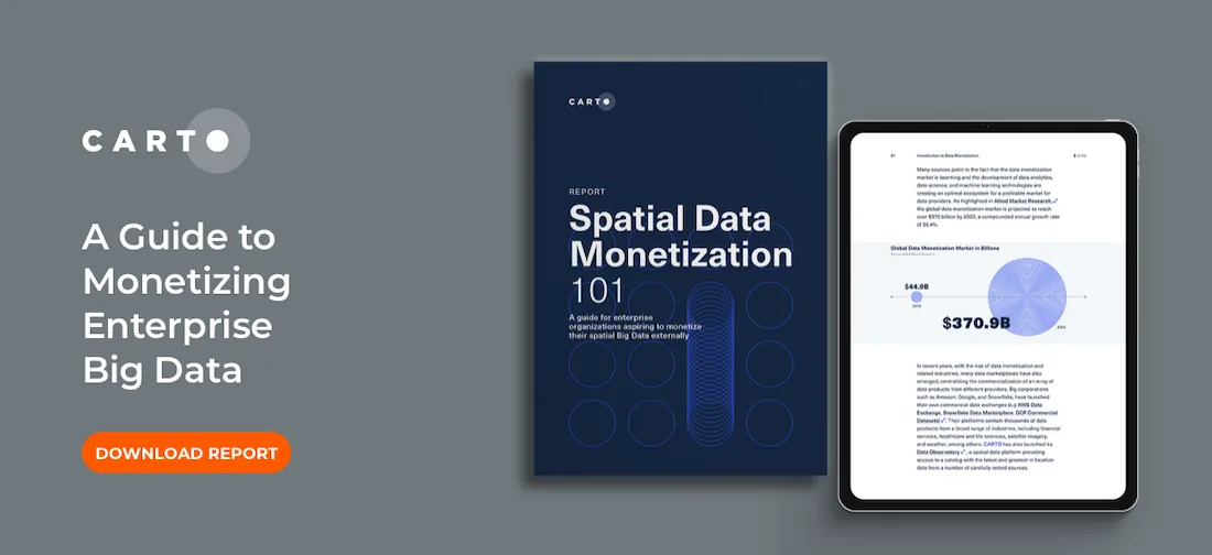
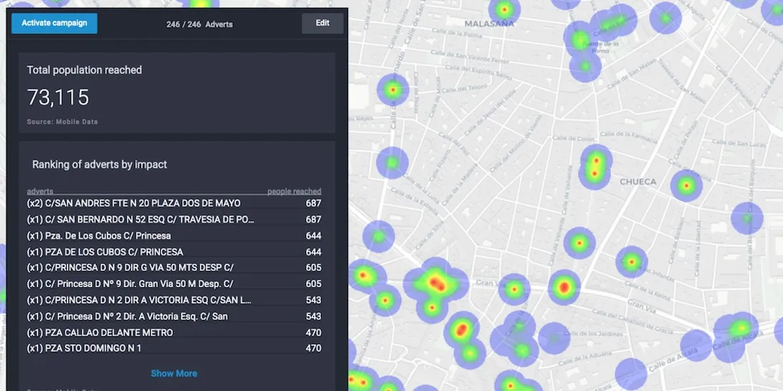
Download our data monetization guide on how to transform big data into a viable product. See how leading enterprise CDO / CTOs from Vodafone & Mastercard do it.
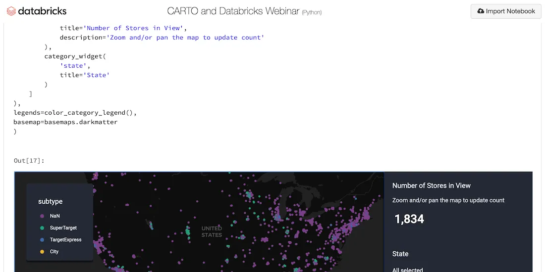
Explore examples of Databricks & CARTO together as part of a collaborative Data Science process including visualizing Big Data sets & creating ETL pipelines.
In partnership with Philip Morris International, Litterati, & Cortexia, read how Spatial Data is being used to combat litter beginning with Lisbon, Portugal.
Read a summary of the DeepFin (where Fintech meets Deeptech) Investor Masterclass we recently held with J.P.Morgan, a leading global financial services firm.
See how private & public sector organizations use Google Cloud Platform with CARTO to share insights & map visualizations relating to the coronavirus pandemic.
With many retailers consolidating stores & focusing on curbside pickup, comparative market analysis real estate can identify twin areas to maximize revenue.
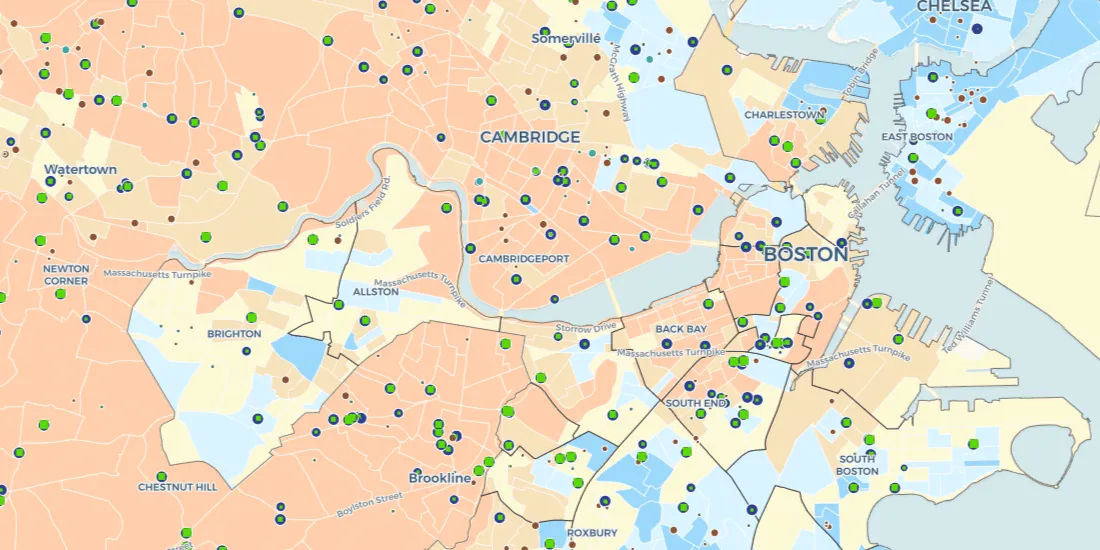
To enable safe social distancing cities are pedestrianizing urban areas & building infrastructure for greener transportation & micromobility. Discover how location data can help.
Read how the Center on Rural Innovation & others used CARTO to determine which rural communities in the US are in need of greater support against COVID-19.
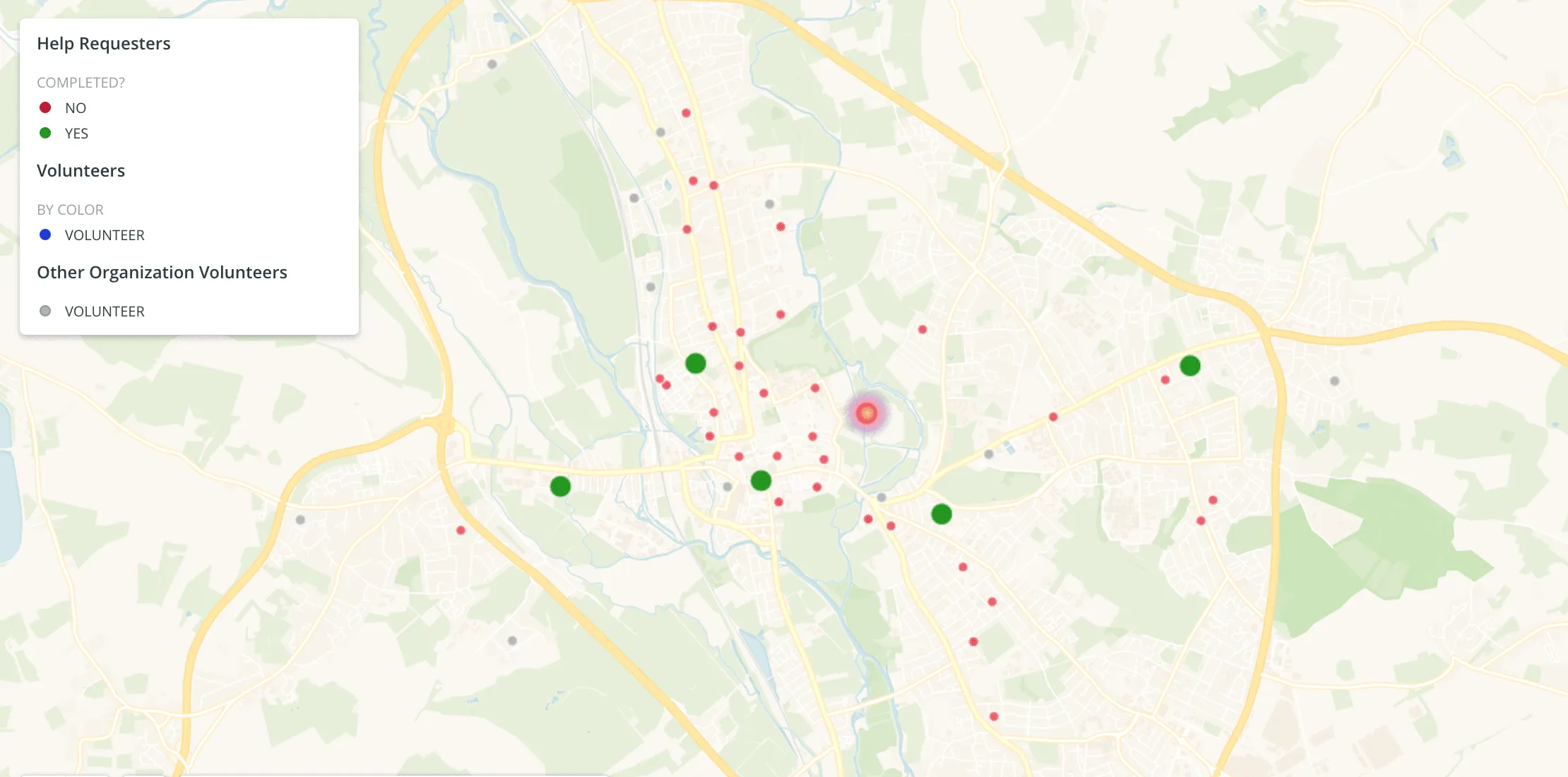
#StudentsAgainstCorona is a platform supported by our grants program enabling the pairing of volunteers with the elderly & vulnerable individuals who need support through the Coronavirus lockdown.
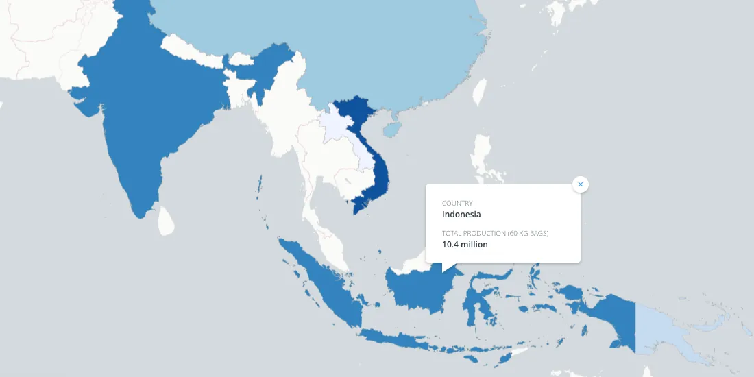
Enveritas leverages Location Intelligence to visualize global coffee production and poverty levels among farmers, as they work towards a more sustainable global coffee industry