
CKDelta’s international human mobility data now available in CARTO
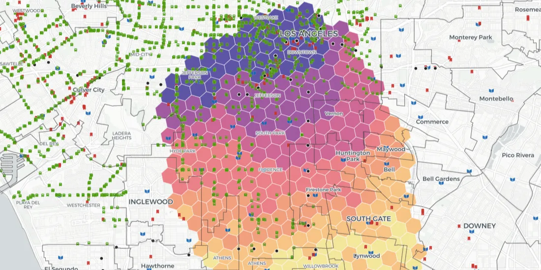
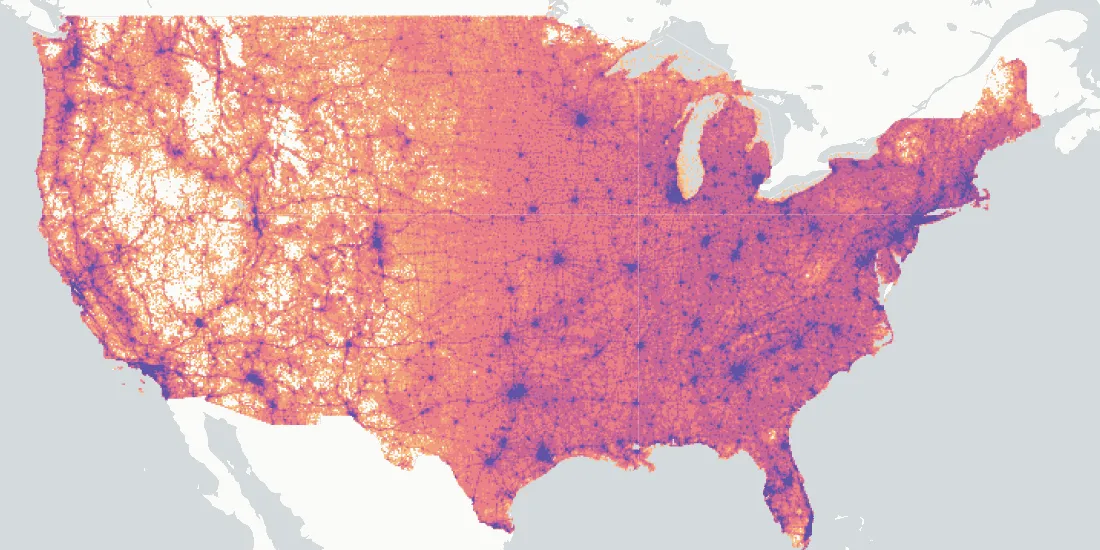
We are pleased to announce our partnership with CKDelta & the inclusion of their human mobility data within our Data Observatory. Learn more & see key use cases.
Spatial DataWe are pleased to announce our partnership with CKDelta & the inclusion of their human mobility data within our Data Observatory. Learn more & see key use cases.
Spatial Data