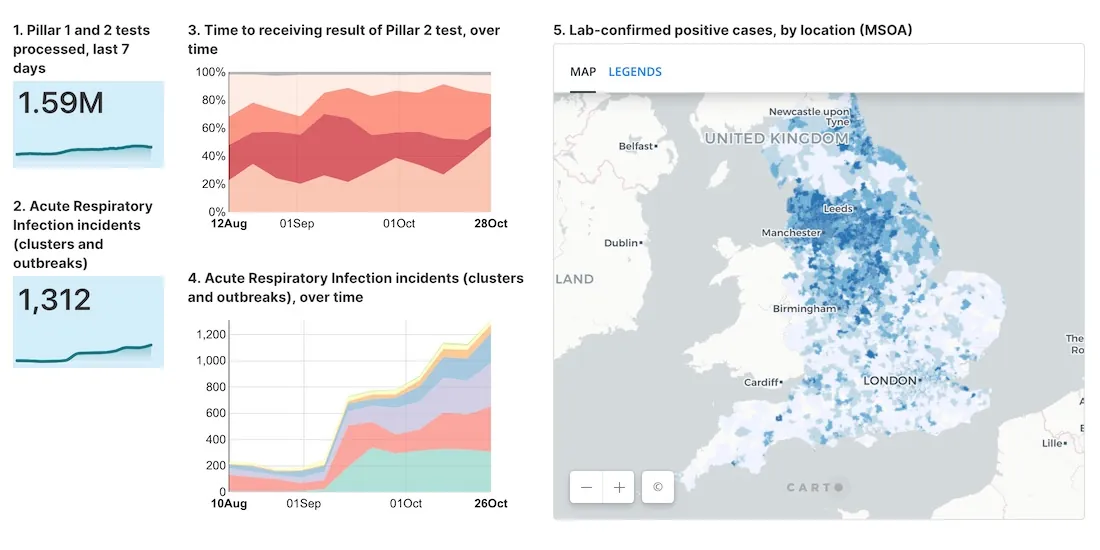
As cases of Coronavirus rebound, having an effective Test & Trace system in place is crucial. A new dashboard with maps evaluates the NHS response in England.
Read about new features to CARTO BigQuery Tiler: the fastest, most convenient, & cost effective way to visualize spatial Big Data & generate Tilesets for the web
Modern Distribution Management, encompassing supply chain network design & logistics optimization, is going through a transformation. See why spatial is key.
#SDSC20 Online starts today! Join thousands of spatial leaders from around the world over 5 days to discuss & learn about the future of Spatial Data Science.
Learn how to visualize geospatial Big Data hosted in Google BigQuery by creating a CARTO instance on the Google Cloud Platform & using our BigQuery Connector.
Aena, in collaboration with CARTO, Telefónica, & Situm has launched 'AenaMaps', a solution leveraging indoor mapping to provide navigation within its airports.
Learn more about our integration with Placekey, enabling universal standard identifiers for any physical place to be used with spatial analysis & visualization.