CARTO showcased innovations in open-source geospatial tech at FOSS4G 2016, including workshops and demos on dynamic maps and mobile GIS app development.
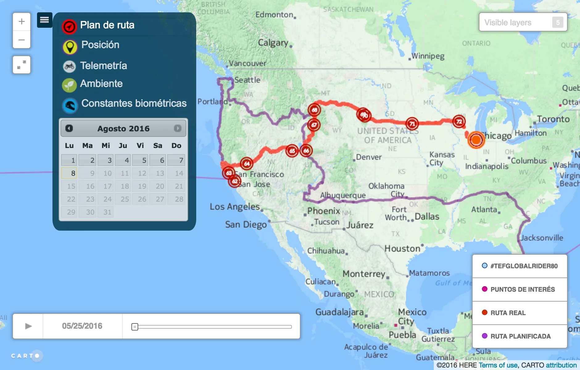
On May 27 2016 Telefónica and Yamaha kicked off Globalrider the world’s first ride-around-the-world fundraiser on a motorcycle where both the rider and.
The Zika virus has been around for over 50 years but it wasn't until this year that the World Health Organization declared it a Public Health Emergency of.
Explore the application of Huff's Law to study population-based attraction in different areas. Use Gravity Models for strategic business location decisions.
Ready to accelerate your big data & cloud capabilities?