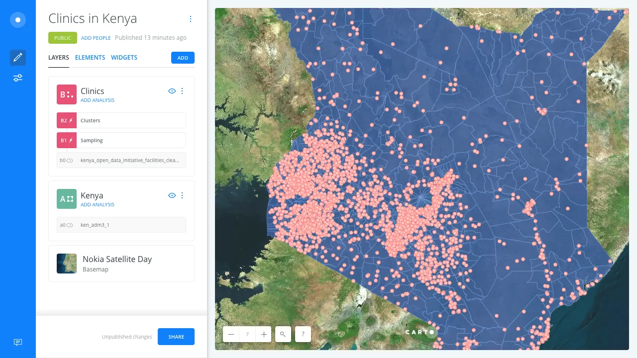
CARTO CARTO Contributors · Nov 22, 2016Mastering layers in CARTO BuilderWhen working with maps and analysis it’s essential to have effective control over the data layer hierarchy and the analysis attached.Spatial Analytics
CARTO CARTO Contributors · Nov 4, 2016Narrow your filter, zero in your data perspectiveWorking with data can sometimes be a daunting task.Spatial Analytics
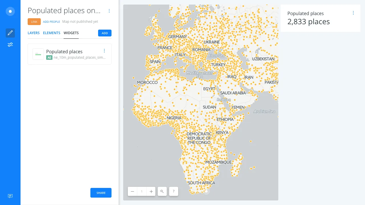
CARTO CARTO Contributors · Oct 26, 2016Widgets Make Numeric Data Manageable and Meaningful for EveryoneCommunicating numeric data as meaningful information to an audience without a background in data science can be difficult.Spatial Analytics
CARTO CARTO Contributors · Oct 10, 2016Creating Animated Maps with CARTO BuilderExplore the power of Torque.js, offering innovative geospatial data aggregation for both time and space. Animate and analyze data trends effortlessly!Spatial Analytics
CARTO CARTO Contributors · Sep 8, 2016Styling with Turbo CartoOver the past few months we have shared some introductory tidbits about our CartoCSS preprocessor Turbo Carto .Spatial Analytics
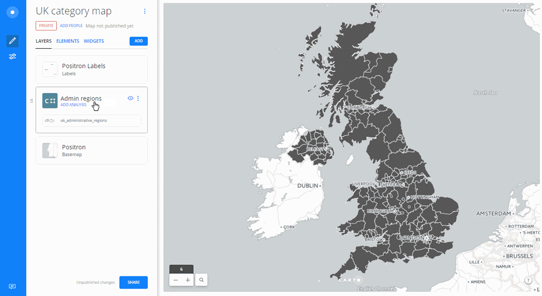
CARTO CARTO Contributors · Sep 6, 2016Creating Category Maps with CARTO BuilderLearn to create Data-Driven Maps with CARTO Builder! Color-code geospatial features by category effortlessly. Improve decision-making now!Spatial Analytics
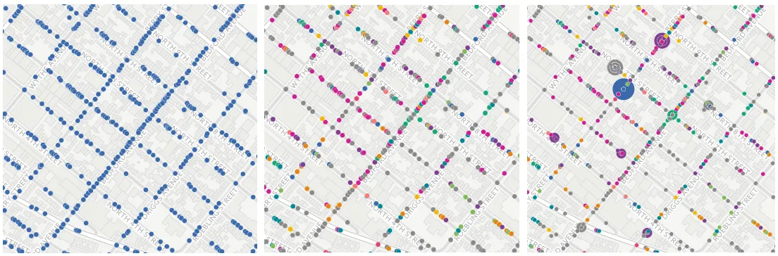
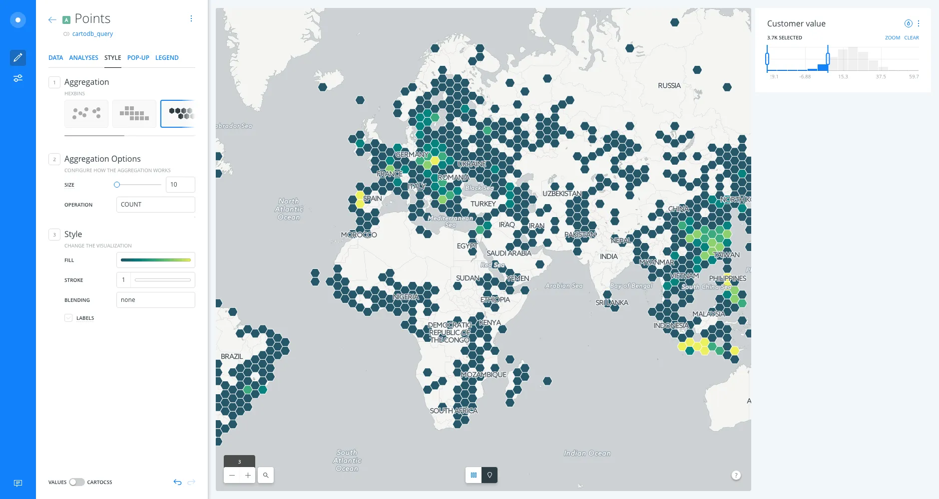
CARTO CARTO Contributors · Sep 1, 2016Better Aggregation Methods for Exploring Big DatasetsFor a long time most GIS tools focused on creating maps with very small datasets.Spatial Analytics
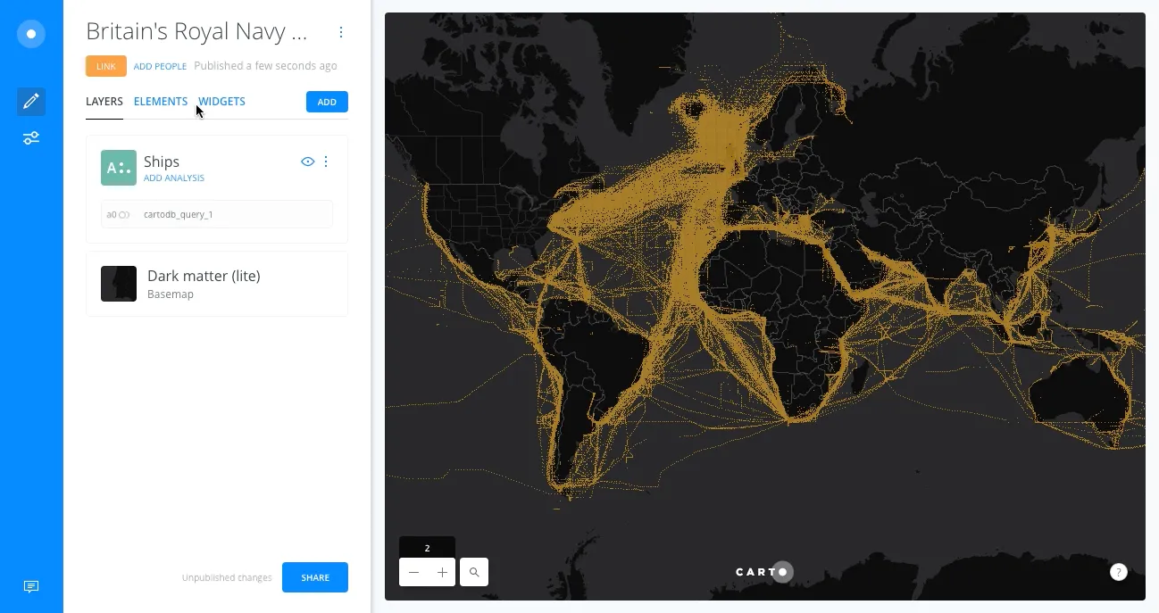
CARTO CARTO Contributors · Mar 8, 2016Routing and Path SectionalsYou might have seen the blog post we produced a little while ago looking at the L train closure and the possible impact that might have on L commuters to.Spatial Analytics
CARTO CARTO Contributors · Nov 8, 2013Online mapping for beginners! A free online course!Join our CartoDB online course on December 3rd at 4PM EST, streaming live from our New York offices. Learn the basics of geospatial.Spatial Analytics
CARTO CARTO Contributors · Jun 28, 2013Got files? We've got a Import APIDiscover CARTO's Import API: Easily upload files without a browser, create visualizations, and explore seamless integrations. Start your spatial analysis now!Spatial Analytics