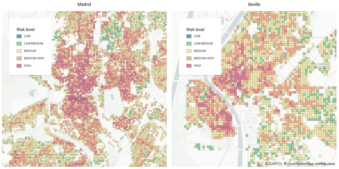
As many parts of the world enter into recession following the Coronavirus pandemic, read how Spatial Data Science can help identify areas with a greater risk
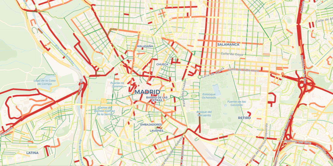
Learn how to import Waze for Cities traffic big data into CARTO using our Google BigQuery Connector for easy analysis & visualization in our step by step guide
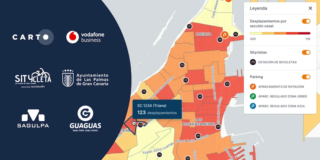
Optimizing transport infrastructure spatially is key to the future of mobility - see how CARTO, Vodafone, & SAGULPA built a platform for the city of Las Palmas
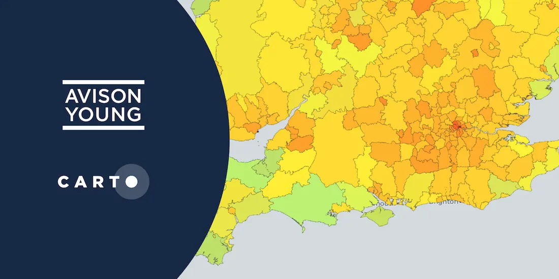
Explore Avison Young's UK Cities Recovery Index, monitoring commercial real estate rebound post-pandemic, analyzing diverse sectors, and predicting recovery trajectories.
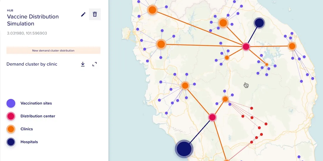
With COVID-19 vaccines requiring strict storage, ensuring an efficient cold chain transportation network using spatial will be key for effective distribution
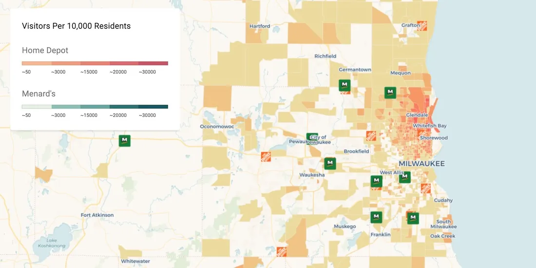
With COVID-19 causing dramatic shifts in consumer spending behavior, DIY & other retailers can leverage geospatial data to discover new revenue opportunities.
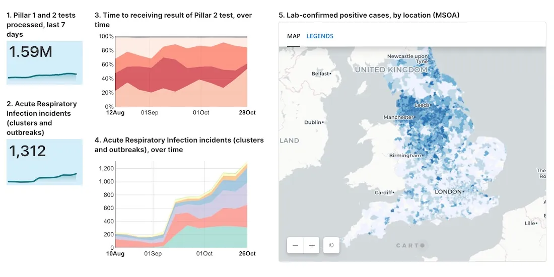
As cases of Coronavirus rebound, having an effective Test & Trace system in place is crucial. A new dashboard with maps evaluates the NHS response in England.
Modern Distribution Management, encompassing supply chain network design & logistics optimization, is going through a transformation. See why spatial is key.
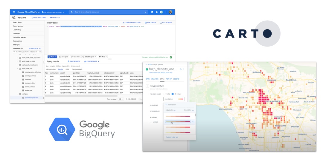
Learn how to visualize geospatial Big Data hosted in Google BigQuery by creating a CARTO instance on the Google Cloud Platform & using our BigQuery Connector.